Luibiskogel
“Im Herbst ist alles möglich.” – these wise words were written to me by a campground owner, regarding the possibility of staying an extra day, but they could equally apply to this incredible day hike. Although canyoning was the focus of our trip, we knew that the hiking in Ötztal was also incredible. I idly scrolled around on Outdooractive and spotted a nice looking peak that seemed quite accessible – Luibiskogel. Some googling later, and I was proved right – it’s a less visited peak, but one that requires no technical glacier crossing or difficult scrambling to summit, just a long steady walk up to 3110 m.
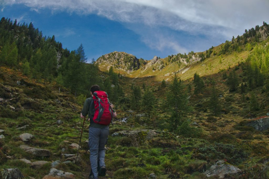
We set off early and parked the car by the town swimming pool. After a quick visit to the wonderfully named Pestkapelle, we continued up the winding forest road and into the woods. On the way up we caught brief glimpses of the world around as the thick cloud periodically lifted. We could see already snow dusting the highest peaks, and hoped that we would soon be up there.
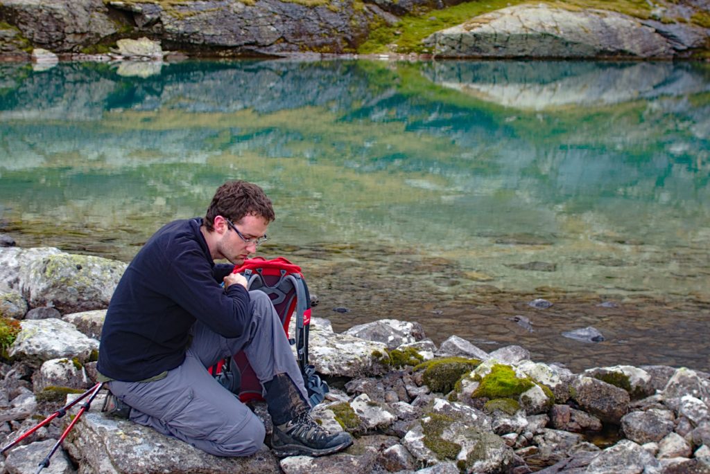
The dense forest gave way to sparse trees and eventually scrubby grassland as we climbed into the main side valley. Above us we could the see the Hausersee hut, and above that Luibiskogel, standing high and unreachable in the early morning sunlight. We stopped by the self catered hut to eat our lunch, refilled our water bottles at the lake and then began to climb the scree slope.
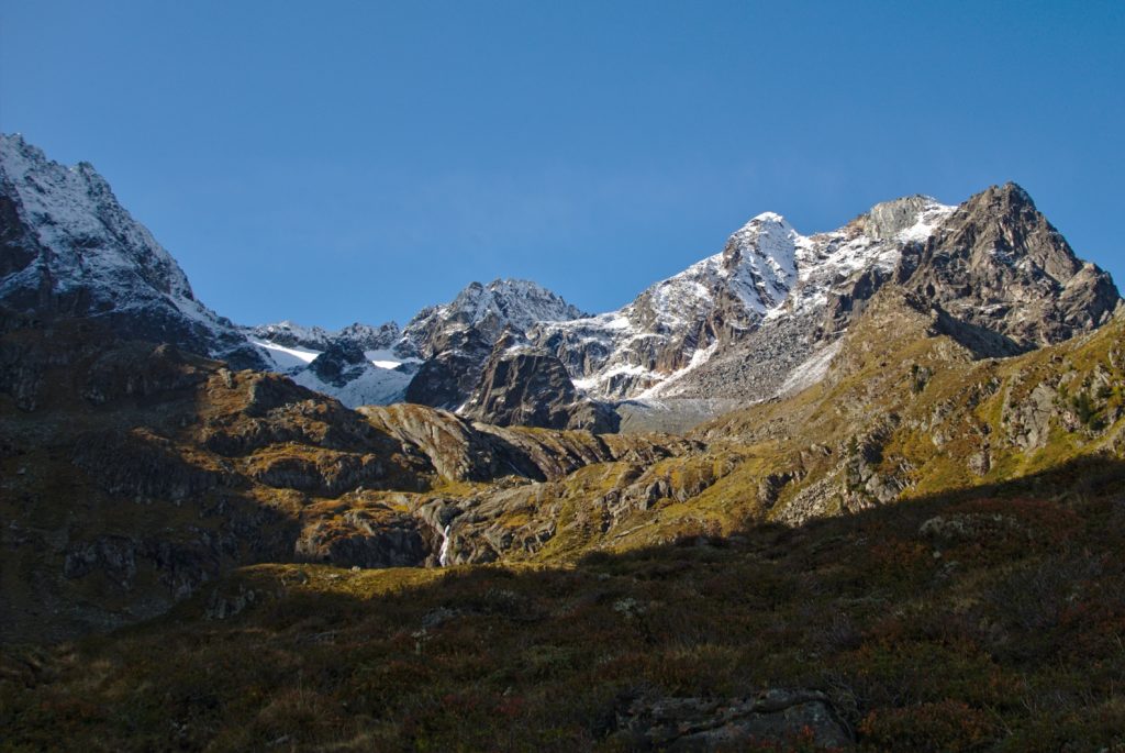
Gradually the snow deepened, and then covered the path. We reached a saddle where a ridge broke down into several smaller peaks, and paused to look up at Luibiskogel. It was less formidable now, as we had skirted round the south side, where the snow had mostly melted, and the gradient was less steep.
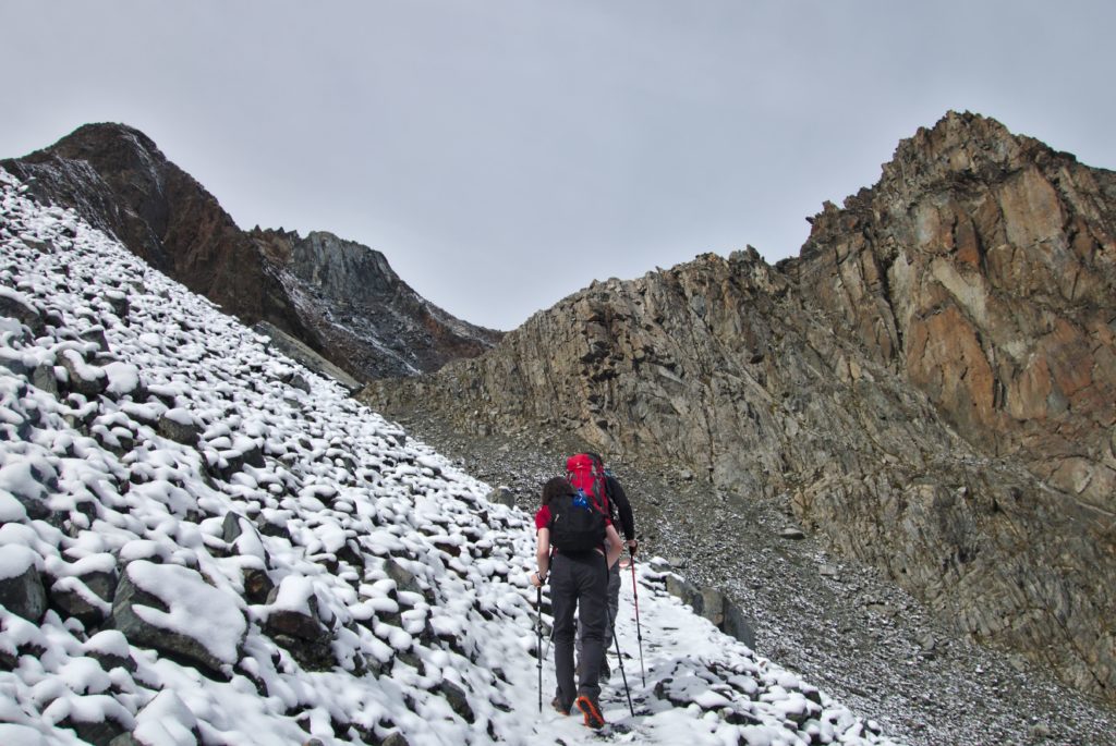
To our south lay the remnants of a huge snow field, and just to its west was a smooth sloping rock surface. This was fixed out with chains and steps, and we clambered up. There was one dodgy sections where there seemed to have been a landslide – no blazes, and difficult, loose scrambling.
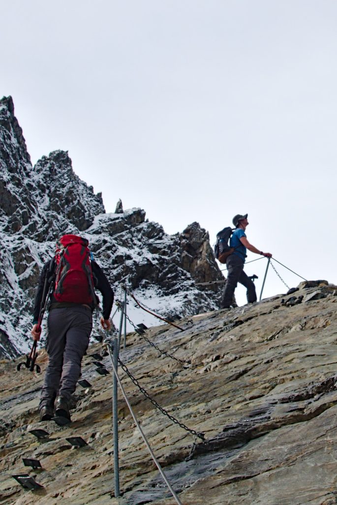
From here the path divided – one way to the saddle at Luibisscharte, and the other up to the peak of Luibiskogel. We paused to eat more food, and then pressed on and upwards.
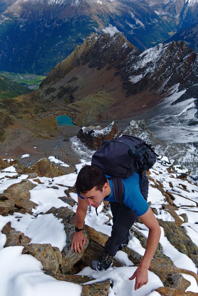
Scrambling gave way to chains, and then loose, slushy snow on flat rocks. The entire mountain seemed to be made from large boulders – where had they fallen from? How is mountain made? The last stretch up to the summit was a bit of a slog as we climbed higher and higher into the rarefied atmosphere (this, and many other “Ascent of Rum Doodle” jokes were made).
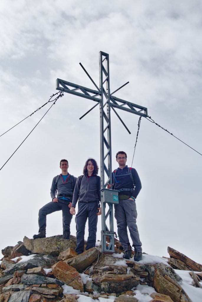
At the summit we looked around. Incredible. We could see mountains in every direction, huge summits in the distance, the mountains of Italy, and it was all beautiful. We signed the hut book and began the scramble down. This was much less fun than the way up, as you were facing the steep slopes directly. Still, slowly we crawled down, keeping low and avoiding the slushy, melting snow.
We made rapid progress back down to the scree slope, which took an age. Another refill of the bottles and we dropped down to the tree line. This was where the proper slog set in – it took an age, and we were tired and our knees hurt. Conversation dried up, unless it was to recall some landmark that proved we were getting close. Finally, after an age of similar looking trees and rocks, we arrived back at the car, ten hours after we had left. 1940 metres up and down, and the highest Alpine peak for everyone in the group. In autumn, everything is possible.
Route: https://www.outdooractive.com/de/route/bergtour/oetztaler-alpen/luibiskogel/108423763/